We arrived back from Los Angeles yesterday evening to a nice surprise of snow in Mill Creek. After leaving our friends’ house on the Rancho Palos Verdes peninsula, we bounced North and West along the coastal beach towns all the way to Santa Barbara, then passed through Solvang on our way towards San Jose. A gigantic storm system was hurtling itself at Sacramento and we started running into showers about the time we saw the artichoke and garlic fields around Gilroy. By the time we crossed the Martinez Straits, we were being rocked by 30 mph side winds and pelted by solid sheets of rain. In Walnut Grove I still felt alert enough to make it to Redding so I called our favorite place there to reserve a room. After 14 hours of driving, a bed never looked so good. We left Redding early. Dawn was breaking over Lake Shasta as we passed by Turntable Bay. Scattered remnants of the overnight storm were nestled in the valleys like giant rolls of cotton candy, pierced by the tips of giant evergreen trees. As we descended the Gilman Grade we soon found ourselves under the rolls of fog, and were rewarded by the occasional ray from the sun, still low in the sky, blazing along a canyon floor and lighting the hanging clouds from the inside. Fresh snow blanketed the higher peaks. When I told my colleagues at work that we were planning on driving to LA and back over Christmas, they asked why we just didn’t fly. The answer, my friends, is in the experiencing, first hand, of the power and the beauty and the grandeur wrought by a Force far greater than we.
Friday, December 31, 2010


Friday, October 22, 2010
Miatas In Moab IV, Part Three

The road had tumbled down off the La Sal Mountains in steep drops, hair-pin curves, and the occasional off-camber sweeper, and I was having a great time – when I could ignore Marilyn’s screams, that is, as she “enjoyed” the stunning vistas with the crystal clarity that comes with the absence of any guard rails! Bedrock is in the flat bottom lands and from there you can see back to the La Sal’s, and you start to get a hint that you are in for a treat. A couple arrived in separate SUV’s, each with a bike and a kayak on the top and a large dog inside – It was time to take our leave – Bedrock was about to be overrun!
We made the turn at Naturita and headed North again towards Gateway and Grand Junction. This part of the trip is through the Dolores River Canyon – a road neither of us had ever been on before. It was easily the prettiest part of our trip, with a twisty road, spectacular rock formations, a clear river, and even some historical sights. Back in the late 1800’s someone found some gold and had the bright idea of forming a company to build a set of “hanging flumes” to bring water five miles along the canyon wall to the placer deposit. The flume is hung from a shear vertical canyon wall, and was such a feat of engineering that it is listed on the register of historical places. Much of the flume structure is still there, and can be viewed from several pullouts along the road. In the end, the gold company went bankrupt from the cost of building the flume, and the lack of gold; the deposit played out too quickly to even break even.
Along with the usual metal and minerals, some “yellow cake” (low-grade Uranium ore) was also mined in small scale operations in the canyon, and the tailings can be seen as you drive along. I have a friend whose family was involved in Uranium mining near this area of Colorado. When he had to get a Secret Clearance, the case worker had to go talk to all his past neighbors. He told the case worker that his town had so much radiation from the miners tracking it back that the EPA dug up the entire town site and buried everything, and then covered it over. There would be nothing left of his home town. During the follow-up, the case worker told him he was right – he had never seen anything like that before – an entire town literally wiped off the map!
But don’t let that st op you from visiting the Dolores River Canyon – the entire area is headed for Wilderness designation, and is covered with miles of hiking trails. Just out of the canyon proper is the little town of Gateway. The story we heard is that the town was built by the founder of The Discovery Channel to house his automobile collection, and to provide a destination in a beautiful spot. It is all modern and new, and we had a light lunch but could not stay because we were running low on time and we still wanted to stop at my step mothers’ house. I called her and explained we were running late and would not be able to stay long, but she told us she was glad we got to see the Dolores canyon – it was one of her favorite spots and she has spent most of her life on the “Western Slope”, as this area of Colorado is known.
We had a too-short visit and then we were off back to the Red Rock Inn for the closing banquet. Mazda had done themselves proud and we all got a goodie bag with a nice coffee table book on the history of the MX-5 Miata, a coffee cup that changes color with heat, bottled water, Miata pins and stickers, and so forth. They sent six pallets of stuff to the gathering, and the Utah Miata Club, Salt Lake Chapter, made the trek down in March, tops down!, to take delivery and separate it out. The winery at Red Rocks Inn let them use their loading dock, and stored the goodies until we all arrived to cart them away. Nice people, both at Mazda, and at Red Rocks Inn.
We ended up sharing a table and bottle of excellent wine with a couple from the other Puget Sound area Miata club, but their names escape me. Once dinner was done, we headed back towards Moab along the river, filled with lots of memories and good food.
The drive home was “fastest time, shortest distance” and we made the 900 mile drive to Richland in just under 18 hours, where we decided that trying to make it the last 4 hours to home was not worth it. Google Maps and Susie-Q, our Garmin Nuvi 660 navigation unit, said we should do it in about 14 hours, but we stop for meals and soft drinks fairly often and don’t over do it. I did all the driving and can say with certainty that the “NC” model, the third generation, is much more comfortable than the “NB”. I loved our 10th Anniversary Special Miata, but Miss Daisy is a whole other level of comfort. The NC is a little harder to get in and out of due to the increased safety afforded by the steel beams in the door and door sills. It is a bit like sitting in a pan, like many other modern cars. However, once I get in, I have support in all the right places. I can drive for hours before I need to get out to stretch, then I can get right back in and drive for more hours. I hope you enjoyed reading about our adventures. See you along the road!
Tuesday, September 28, 2010
Miatas In Moab IV, Part Two

The red jeeps were sitting outside a convenience store just out of town the last time I saw them, but now they became rapidly growing red dots in my rear-view mirror as we headed up the narrow canyon. Construction equipment, towering walls of red-rock on the right, drop offs to the Colorado River below on the left – none of that deterred the testosterone fueled rent-a-jeep jockeys as they whipped back and forth through and around our small Miata caravan. A small cry of relief escaped Marilyn’s lips as the last of them barely squeezed between the lead Miata and an oncoming diesel pickup towing a trailer full of river rafts – and then they flew up the canyon and were out of sight in a blink. We were on Day One ( Friday ) of Miatas In Moab IV, on our way to a very special group of arches in BLM land just outside of Arches National Park. Bow Tie Arch and Corona Arch are reachable via a short drive out of Moab and then a 1.5 mile trail, most of it over “slick rock”. The lower part of the trail is fairly easy, the way marked by rock cairns, but the upper part is reachable only by a climb up a ladder set vertically into the rock and a scramble over uneven surfaces before it smoothes out again. The arches are visible from the end of the lower trail, but for the full impact, it is well worth the climb and scramble to reach the weeping garden wall kept moist from the slow seep below Bow Tie and the magnificent spectacle of Corona. I recommend you take the following link http://www.utahredrocks.com/hike_corona.htm to get a feel for this very special place. These were the only arches we saw this trip, as we had hiked extensively in Arches National Park during our previous visit four years ago when we attended Miatas In Moab, The Sequel.
This time we wanted to take a drive by ourselves to see my step-mother and step-sister who live in Grand Junction, Colorado. There was to be a drive called “Run Round the Mountains” on Sunday morning, but we were planning on leaving that day, so we hatched our own plan – and that is exactly what the planners of MiM-IV had in mind, as there were not a lot of planned drives – this time you were encouraged to amuse yourselves. We decided to take this one planned drive and hike because it is nice to go with a knowledgeable and enthusiastic leader. On the way back he stopped to point out petroglyphs along side the road – which we surely would have missed had we been on our own.
We went back to the Canyonlands Inn to change clothes, and to buy some Miata goodies. Thompson Automotive showed up with Miata Hawaiian Shirts, and those were easily the most popular of all the Miata-themed merchandise. The first time I wore mine at a PSMC event, I was inundated with questions as to where I got it. Here’s a link to where you can get your own: http://www.thompson-automotive.com/Shirts.html
Then it was off to a good lunch at the Moab Brewery and then a visit to “Hole in the Rock”, a tourist trap which was originally the 5000 sq. ft. home hollowed out of a huge rock formation by a hard rock miner for his wife. The tour was short but interesting, and the grounds were filled with interesting things to pose by and take pictures of. We stayed longer than we had planned, and had a great time for being somewhere so tacky!

That evening the storm clouds rolled in and the Western Show and Gun Fight complete with a rubber chicken being shot out of the sky, just barely ended before the wind calmed and the rain started. We were at the Bar-M Chuckwagon, where you are served cowboy-style on tin plates and cups, over a gravel floor, and on rows of picnic tables. It was all good fun, and the food was OK, but in my opinion, the musical show after dinner was the best part. All four of the principals are accomplished musicians, and it shows. The music was Cowboy, the ambiance was Country, and the jokes were Corny. When they played and sang “Cool Water”, they encouraged audience participation by breaking out Super-Soaker water pistols and soaking down anyone not singing along to the refrain, “Cool, Clear, Wa-ter”! As the night progressed we found that the owner, who played the marshal in the opening gun fight, plays lead guitar, is also the lead vocalist, and is camp cook, as well. The other three are equally adept at various roles, and it was a treat to be part of their dream living the Western Way. The Bar-M Chuckwagon – check it out here: http://barmchuckwagon.com/theshow.html.
The next day we enjoyed a very good breakfast at Canyonlands – they have really done a nice job of turning a small meeting room and open area into a kitchen and eating area, and the food was great, especially considering it was part of your room. Then we headed South out of town towards the La Sal Mountains. We had heard about a cute General Store in Bedrock just over the border in Colorado, so stopped there – it may have been cute and bustling once, but the store was for sale, and it has clearly seen its better days. Still, we were glad we stopped to take a few pictures and spend a little cash, because these little stores are fast disappearing from the landscape.
Saturday, September 25, 2010
Miatas In Moab IV, Part One

They don’t call Hwy 50 through Nevada “The Loneliest Highway in The US” without good reason, and we are six miles off that road on a jeep track. Miss Daisy, our 2009 Competition Yellow MX5 Miata doesn’t even have 2000 miles on her odometer, and I don’t think she is too happy with my taking her out in the rough. I’m hoping she doesn’t get even with me by having a flat – It’s a long way from where we are to anywhere and I think the buzzards have taken an interest in us… The sign back at the highway (if you can call two-lane blacktop a “highway” – that’s as good as Hwy 50 gets) said we could see earthquake faults just six miles away. Well, heck, we are on day three of our journey, behind schedule (our usual state of affairs on road trips), and Miatas are not known for off-road capability – “Sure, I’d like to see them, too”, I had replied to Marilyn’s request. This area near Fairview Peak had experienced a magnitude 7.1 earthquake on December 16th, 1954. The area we are in has some of the largest and best preserved fault scarps I have ever seen. While the average displacement in this extensive system of faults had been 1.2 meters, here they are over 5 meters. We would like to hike up to the area showing the greatest displacement, but we choose to take some pictures and point Miss Daisy back towards the highway – we have a lot of miles still to go before we reach our destination in Moab.
It all started some months ago when I decided to try to get a room for “Miatas In Moab IV”, to be held May 14-16, the fourth in what has become a bi-yearly event put on by the Utah Miata Club. We had enjoyed “Miatas In Moab, the Sequel” (it was the second time they had put on this event), and wanted to find some dry roads and sunshine, and introduce Miss Daisy to about 225 of her kin folk. Now for those of you who have gone on one of our drives know, if there is a back road between Point A and Point B, even if that road takes you through Points C, D, E, and F, that’s probably the route we will take. In our case, the “points” were Bend Oregon and Virginia City, Fallon, and Ely Nevada. If you put those towns in Google Maps you will see that instead of the nice straight diagonal between Seattle and Moab, you will have the “other two” sides of the triangle, with the turn at Virginia City.
The first day was mostly a shake down; it was the first long trip in Miss Daisy, and we had left directly from work – it was late when we got into Bend, and early when we left. Day two took us along Hwy 97 through the “Oregon Outback” – which is a very apt description. We made sure we kept the tank topped off, as there are several long stretches of road without operating gas stations. Just after entering California we found a place making plum wine like my grandfather used to make, so we stopped for a tasting and of course a few bottles to take back. We hit Reno at rush hour and were glad to escape the traffic to turn up the steep and winding narrow road into Virginia City. Even though many shops had closed, there were enough still open to give us a chance to stretch our legs as we poked about the old antique mining gear, sundries, clothes, and tools from a bygone era. Everyone we asked about restaurants mentioned the same place and so we had a wonderful dinner of Mexican Fried Pork, Chile-smothered Burritos, and Margaritas. Heading East down off the pass, it is only another 60 miles until we reach our motel room in Fallon. Fallon is home to one of our “Top Gun” fighter schools. Exhausted but amused, we can only wonder what maneuvers our “Top Guns” have performed in this room, where every wall is covered with mirrors…
Breakfast the next day is at a wonderful 50’s style diner. It’s got fast service, good food, and has a menu and décor, and jukebox, that transport us back to simpler days. We finally realize that we on a vacation, however short, and we are looking forward to some of the stops we have planned along Hwy 50. We noticed an espresso shop and gas station next door to the diner, so we get some high octane for Miss Daisy and high test for us, wipe the bugs off the windshield, and take Hwy 50 East out of town. Tonight we have reservations in Moab.

The plan is to stop at each of the towns between Fallon and Ely, and see the charcoal ovens outside of Ely before continuing on into Utah where we will eventually catch the I-15 and I-70 Superslabs – we figure we should get to Moab in time to get registered for MiM-IV. Now, we’ve done some research and so we can pick out points of interest, like the huge sand dune where folks play with their jeeps and sand rails. We’re buzzing right along and I start figuring the distance to Middleton when Marilyn points out the sign to the earthquake faults. Now I’m a sucker for geological features, and six miles doesn’t sound too bad, and the jeep track looks pretty good, and that’s how we ended up outside of Fallon, Nevada, six miles off the highway, on a jeep track, in our new Miata, with a blown schedule.
Besides being “Lonely”, Hwy 50 is interesting for two other reasons. First, a large portion of it was an alignment of the Lincoln Highway, which was the first coast-to-coast highway in America. There are several original or replica Lincoln Highway sign posts along Hwy 50. The Lincoln Highway, in turn, followed several popular emigrant trails, including the Oregon Trail, the Pony Express Route, and the Mormon Trail. Middleton is an original Pony Express stop. Second, this area of the country is known as the “Basin and Range”, because it consists of North-South valleys, or basins, separated by steep and high mountain ranges. Each range seems to have some little town built around one or another mining operation.
Middleton, however, is in the middle of  a “basin”, and was situated here because a spring nearby provided water for the horses used by the Pony Express Riders. We stop for a soft drink and are amazed by the dollar bills, each with a name or names written on them, covering the ceiling of the only building in Middleton, which serves as gas station, restaurant, general store, rest stop, and tourist attraction. There are buggies, old car parts, and old tools and mining equipment strewn about, and across the road is what appears to be an original Lincoln Highway sign. We would have liked to stay longer, but the siren call of the road calls to us. Zoom-zoom and off we go.
And zoom-zoom we do, as most of the road in the basins is arrow-straight and there is no one else out there. At one point I saw the speedo was indicating, well, pretty darn fast, OK?, before Marilyn noticed and started “talking” to me. Like most men, I would rather eat broken glass than be “talked to”, so I dropped Miss Daisy well back into double digits and we enjoyed the rest of the ride into Ely; along the way we made brief stops in the several mining towns and dodged the weather we could see off in the distance. Outside of Ely we saw the signs to the Ward Charcoal Ovens State Historic Site, but alas, it was too far off the road and we did not have enough time. Likewise with Great Basin National Park. And the site we heard about where you can collect your very own garnets. We will have to come this way again.
It was dark when we reached the Interstate. We stopped at the last restaurant before Green River, a stretch of 200 no-services miles, then turned south and arrived in Moab just before midnight, local time. The entire parking lot was full of Miatas – Miss Daisy sighed contentedly and we all went to sleep. Next up: Arches, Gun Fights, Hanging Flumes, Pallets of Goodies, and Grand Junction.
Friday, September 11, 2009
Pre-dawn run, Miatas in Moab II

You briefly take your eyes off the black ribbon of asphalt unwinding before you to exchange silly grins with your well-bundled co-pilot -- words are just whipped away by the icy-cold wind. Your Sapphire Blue Miata is near the end of a long line of speeding Miatas, tops down, heaters blasting, in the darkest hour before dawn, and a crescent moon and billions of stars twinkle in the cold desert sky. You see the line of nimble roadsters stretching into the distance, their head and tail lights painting a moving, twisting undulating line in the night as they gracefully crest hills, swoop through turns, and disappear briefly in the hollows, only to reappear already turning over the top of the next rise, and all the while being bathed in a crescendo of richly varied exhaust notes and alternating heat and cold as the slipstream holds, then releases, your little bubble of warm air. Mile after mile, turn after turn, this mob of Miatas swarms through the night; straight-aways, when encountered, are taken at eye-watering speeds to close the gaps, then a flurry of fast shifts makes your tach needle bounce toward the red, a stab of brakes to set the suspension and then you zoom-zoom through the turn and into the next set of twisties. Time seems to stand still on this ancient track as you and your passenger follow a leader somewhere far ahead and lost to sight towards some mysterious destination; then you notice the hectic pace slowing and there they are. You see fifty or more Miatas packing a small car park, spilling out along the road, taking refuge where they can in the gray pre-dawn, all is hushed now but for the tinking and clinking of hot engines beginning to cool, muffled sounds of doors shutting, quiet conversation, and now the steady tread of drivers and navigators turned pedestrian walking quickly yet quietly towards the goal, arriving just as the sun starts it's climb out of the canyon depths framed against the glowing purple dawn by magnificent Mesa Arch.
That's the way it happened, during the second Miatas in Moab tour, 14 May 2005.

Sunday, July 26, 2009
Friday, October 13, 2006
Some corrections, and an addition
http://www.eg.bucknell.edu/~hyde/jackson/lindaOregonTrip.html
The site includes pictures of both Register Cliff name carvings, and the ruts cut in stone.
I think I have all the other typos out, now, too.
For the bikers in the audiance
http://www.uni-go.com/
http://www.uni-go-trailers.com/
Forced hiatus
Saturday, October 07, 2006
Mill Creek WA -- The end of the trip, but not the blog.
Lots of chores to do this morning, so this will have to do for now.
For the readers not completely bored at this juncture, remember I left off in the middle of the Natchez Trace. I will pick up the detailed story line at the birth place of Elvis Presley, Tupalo Mississippi, and maybe trace his path North to Nashville Tennessee.
Butte MT
Reasonable speed limits allowed us to travel about 622 miles today, and we are both tuckered out.
More to follow.
Rapid City, SD
We took a quick swing through the Badlands, which are as scenic as ever, and since this is late in the season, and was late in the day, we had the road pretty much to ourselves. We stopped at the old homestead hoping to see a friend we had made years ago on another trip through the region, but she wasn't there. The docent on duty, however, had her phone number and called her for us, so we got to talk to her and re-exchanged mailing addresses.
Wednesday morning found us in Rapid City SD, and unfortunately we cannot begin to do justice to this area. Deadwood. Boot Hill. Sturgis. Crazy Horse. Mount Rushmore. Black Hills. Pigtail Bridges. We have seen it all before, of course, but still, it will be a real pity to just pass it by this year. We need to be in Spokane by Friday to see Marilyn's brother who will be undergoing some surgery, and time will have to be managed carefully if we are to make it.
I have not been feeling well since dinner back in Worthington. I chanced some Cajun Seasoned fish, and they must have used flour to bind the seasoning. I am gluten intolerant (mild Celiac disease) and so must avoid all wheat products. Hence, not much writing -- just wasn't up to it.
Wednesday, October 04, 2006
Worthington, MN
Tuesday, October 03, 2006
Rockford IL
Saturday, September 30, 2006
Day 8 -- Natches MS to Tupelo MS
If we had skipped the Southern-most portion of the Natchez Trace, we would have missed the very best.
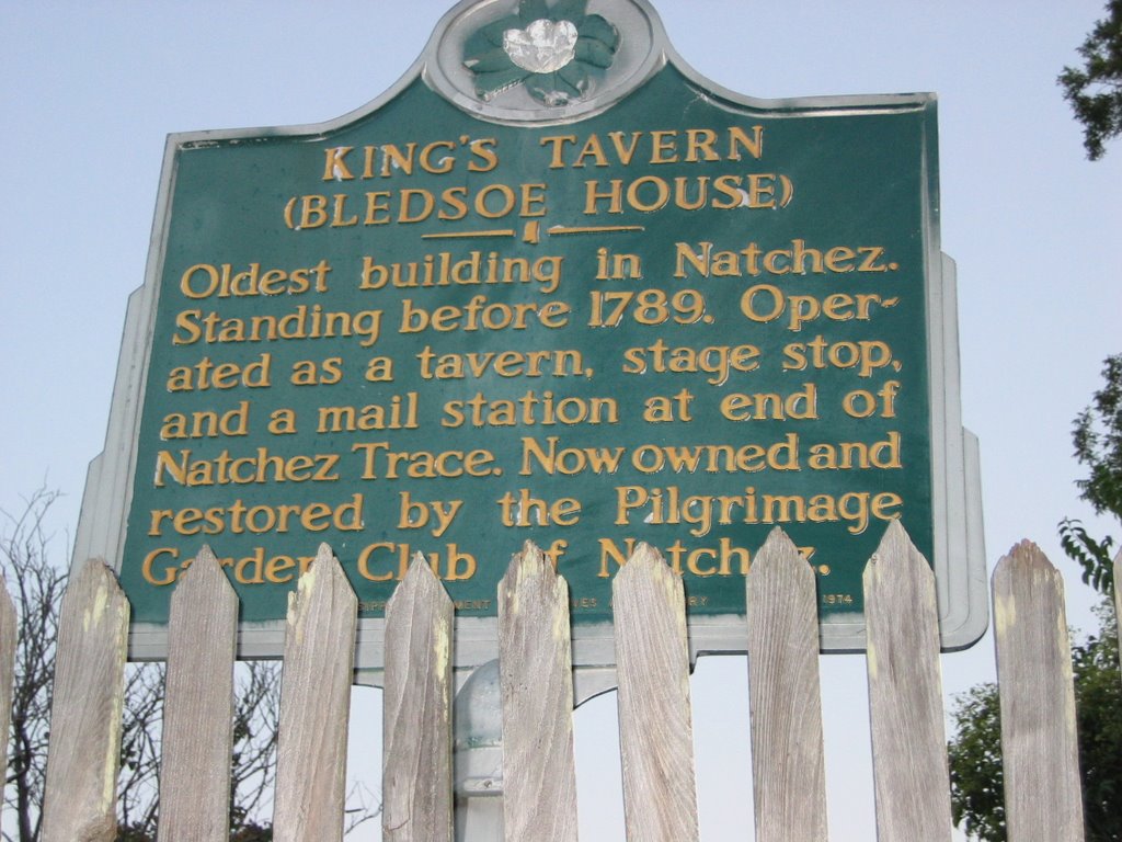

Natchez has a fascinating history that I cannot began to do justice to. I'll just talk about some of the things that stuck with me. Natchez was an important trading outpost very early in the settlement of the Southeastern portion of the continent. It has been under Indian, French, Spanish, English, and US control. After the Natchez Trace was made into a "road" of sorts by the Army in 1801 to 1802, Natchez was tied fairly directly to the North. Thus when talks of secession began, Natchez was more of a Northern town than a Southern; still, when Mississippi voted to secede from the Union, Natchez threw it's support behind the state, causing families and neighbors to divide their allegiances. Being so far removed from the main areas of conflict, Natchez was undamaged from the Civil War and thus retains most of its historic buildings, including businesses, homes, and the mansions of wealthy plantation owners, lawyers, and businessmen. In 1830 the first steamboat docked at Natchez, and from that time on, the Natchez Trace, and the town of Natchez, declined in importance as the port of New Orleans and the Mississippi River took their places. The Civil War took a huge toll on the South in terms of financial strength, and once the war was over, the Cotton Boll Weavel completed the devastation of one of the South's key industries. In talking to some of the locals, it is my impression that many areas of the South, Natchez included, are only now making any kind of a come back, and most of that is based on tourism. Pictured here is the Kings Tavern, reputed to be haunted, with great prime rib, and the oldest building in Natchez.

We found the Natchez Coffee Company, a very nice espresso and ice cream shop, for our morning wake-me-up, and then decided to tour one of the magnificent antebellum homes nearby. We chose the "Melrose" -- http://www.nps.gov/natc/historyculture/places.htm -- and -- http://travel.yahoo.com/p-travelguide-2990729-melrose_natchez-i -- as it is the best-preserved of all the Natchez homes, due to its being in the ownership of only two families before its sale to the National Park Service.

Built by a wealthy lawyer who later became a plantation owner, as well, the house, grounds, and outbuildings are stunning examples of the very best craftsmanship of its time. All the original furniture and furnishings still exist. The style is Neo-Grecian, with columns supporting the upper stories. After several family tragedies, the first owners sold the entire estate to another family who passed it down until the last one, still making her home there, died in, I think, 1979. The tour is well done, and we were allowed access to the first and second floors of the home, and one building that was one of the slave quarters. This brings up the juxtaposition of exquisite beauty and profound misery, as all of the manual labor required to run the house and keep the grounds came from slaves who lived on the grounds.
Architectural features helped make the house livable -- the attic features opening windows that served to draw air up through the structure, which would have helped cool it. A full basement was used to store furnishings not in use and various food items in relative coolness.

A foot trail used by several different Indian tribes and nations between Natchez and the Nashville area existed for centuries. The Mound Builders, or "Upper Woodland People" build burial and ceremonial mounds along the Trace. Natchez was an important port city, and became a banking center, home to plantation owners, and supply depot.

Traders and trappers would journey from their homes in the Northeast into the Missouri and Mississippi River systems, build "flat boats" -- glorified rafts, really, and start downstream gathering furs and trading as they went, until they reached Natchez. There they would sell their boats for the lumber in them, sell any remaining goods, buy supplies, and start North on the Natchez Trace either on foot or horseback. The journey back to their homes could take as long as 6 months through the snake and insect-infested swamps and woodlands, and at any point they could be set upon by thieves, wild animals, or renegade Indians. Places to sleep or get a meal were scarce -- known as "stands", they may or may not have anything to offer, as they themselves were dependant on the Trace for supplies. Still, the Trace was the only reasonable way to make your North at that time, and unlike the Oregon Trail, where wagons would spread out for miles across the prairie, the Trace was essentially a single-file foot path that countless feet and years of erosion wore deep into the land. Today there are places where the Trace is 8 feet or more below grade, a U-shaped cut that is twenty or so feet across.

The section of the Trace between Natchez and Jackson contained many examples of "sunken" traces, and is, I think, the most scenic portion of the modern 2-lane road which comprises the Trace today. Traces of the original Trace can be seen in many areas, and there are many historic sites just short walks from the road. And there are places where one can walk on the original Trace, literally in the foot steps of such legendary figures as Davy Crockett, Daniel Boone, and Meriweather Lewis. More on him, next time.
Friday, September 29, 2006
Day 7 -- From Clarksville AR to Natchez MS
Friday dawned with clearing skies and a fresh clean appearance following the overnight rainfall. The bugs had been in full voice last night while I was enjoying the lightning storm and now the day shift was filling the air with, well, day-bug songs.

We headed South through Little Rock (well, around Little Rock -- the highway bypasses the city to the East), and picked up US-65 into Louisiana. Corn gave way to mile after mile of cotton fields ..."in dem ol' cotton fields back home". We were treated to harvest season. We saw lots of closed gin mills and some interesting equipment out in the fields. It appears that cotton ginning has gone mobile -- the fields are picked mechanically, cotton fed into mobile gins to remove the seeds, and then packed into special trucks that bale the cotton and transport it to the edges of the fields for later pickup. That's one in the photo to the left. Tarps are spread on top of the bales, and numbers, probably the supplier ID, painted on the sides.
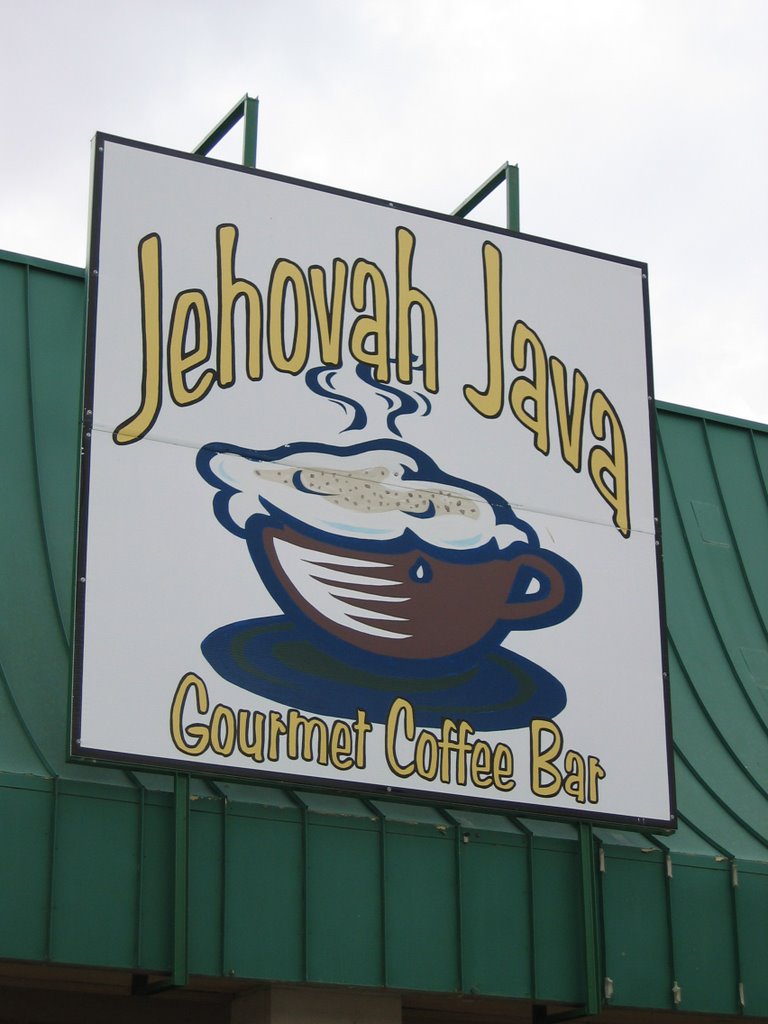
About 30 miles outside of the little town of Lake Providence, we encountered a sight for Sore Seattle Eyes: it promised that somewhere ahead we would find "Jehovah Java". Ahhh.... now since leaving Wyoming, the most important, and sometimes most disappointing part of the morning ritual was finding espresso. I had offered to pack our LaPavoni for the trip, but Marilyn was sure that we would be able to find espresso on a regular basis. For once, I was right, but it was nothing to gloat about :-( Well, a sign closer to town again promised "Jehovah Java" ahead, and so we really started watching. We went though town, and saw a sign for a bakery, but no Joe. Hmmm.... Seems to me that the coffee should be close to the donuts, so we turned around and this time saw the sign pointing down another street. Oh bliss. The espresso was real good. Excellent, in fact. They import their beans from Seattle, and they ain't Starbucks! Starbucks, we both agree, is over-roasted and bitter and we only drink it when we are desperate. No, Jehovah Java was a real find and was a real nice coffee house with home made sandwiches and salads in a nice atmosphere. It was started by a Baptist minister who donates all his proceeds to his church and the shop, while obviously Christian, is tastefully so and doesn't smack you upside the head with preachiness.
On the way into Lake Providence we encountered a rain storm of biblical proportions -- the drops were as big around as marbles and bounced a foot off the pavement when they hit. I had the wipers on full throttle and still had a hard time seeing the edges of the road. It was dry while we enjoyed our lunch and espresso, and I noticed to my satisfaction that all the bugs had been washed off the car during the deluge. Just out of town we hit another rain squall almost as heavy as the first. It sure can rain down here!
We had been making good time so we decided to push on into Natchez instead of picking up the Trace in Jackson. So on we went further South, crossed the Mississippi, and pulled into the visitors' center about a minute before closing. There, a very nice young lady spent a good 15 minutes after her shift should have ended and told us how to get on the Trace in the morning, what we should do in Natchez -- and there is a lot to see there -- and even gave us motel recommendations. This sort of generosity and graciousness typified our interactions with everyone we met in Louisiana and Mississippi. It was a welcome change from our normal lives where it is common to have doors slammed in your faces if you show up close to quitting time.
We went to find the city's grand hotel, the Eola, but opted to look elsewhere when we heard the rates. But we did do a quick tour of downtown and were glad we decided to go the extra distance. Natchez is a wonderful old Southern town, spared from the destruction of the Civil War, and being renovated a bit at a time. We had to choose between a supposedly haunted prime rib place in the oldest Inn in the city, a place that has a reputation for the best steaks in town, or Fat Mama's Tamales with Knock You Naked Margaritas. Hoping for some good spicy food, we chose Fat Mama's. The tamales were OK, but too bland, and they only had pepper sauce to heat them up. What they really needed was some good green chili sauce. The margaritas didn't knock us naked, but they were pretty good. If I hadn't had to drive back to the motel I would have had a second one just to see what would happen :-) It was night time but hot and humid -- pretty miserable for a couple of people used to 65 degrees. The air conditioners poured excess moisture out of the rooms at such a rate that the walkways outside the rooms were slanted to take the water away from the building. Not much to do but crank it up towards "Ice Age" and hope that the room will get cool enough to sleep.
So this is where I started this blog, and once again it is way too late and I really need to get some sleep. We will do some tourist things here in Washington, D.C. tomorrow before we head towards the Indiana Amish community. Hopefully I will get a chance soon to write about the two fascinating days we spent coming up the Natchez Trace, our short day between Nashville and Knoxville, our shopping trip that included the Great Smoky Mountain Knife Company and the arts and crafts community out from Gatlinburg, the glimpse of the Biltmore Estate and Asheville, and the two days up the Blue Ridge Parkway. Ta ta for now...
Day 6 -- From WaKeeney KS to Clarksville AR
Marilyn sez:
Thursday we traveled through part of Kansas and Oklahoma into Arkansas – five hundred and sixty-four miles – keeping one step ahead of a tornado. The winds in Oklahoma were so strong it was hard to stand. Between Oklahoma and Arkansas we saw an incredible lightening show, but the rain did not hit until we were safe in our dumpy little hotel in the Arkansas Ozarks.
Tom adds:
Dumpy, yes, but it had wireless Internet!
It was time to do some laundry, and I was elected. Actually, as you may guess, only one vote counted! The washer and dryer were outside in a covered breeze-way, and while the load washed, I enjoyed watching the lightning and counting the seconds until I heard the thunder -- Sound travels around a mile in 5 seconds and the closest strike was less than half a mile away. Pretty intense!

Back to the day's drive, the winds were extremely heavy, and from the side much of the day. Even Roxy was a bit unsettled as she took us in and out of the calms in the lee-sides of the semi's we passed. As night fell, the lightning ahead illuminated the clouds from the insides, an effect that was magical and eerie at the same time. Only a few pictures today, and they were of strange shelters in an Oklahoma rest stop. I couldn't figure out whether they were teepees, UFOs, or UFOs captured in teepees. Whatever, they were interesting.
The change in landscape was most noticeable today. We left the corn and wheat fields of Kansas where trees were scattered, planted mostly around houses for windbreaks or following gullies or along streams where they could find water. Gradually crossing Oklahoma in a Southeasterly direction, following the toll roads and then I-40, we saw more and more trees until finally in the Ozarks of Arkansas the plains were no more. Folded hills and then rocky outcrops, with heavily wooded valleys became rugged mountains with panoramic views. I'd like to spend some more time in the Ozarks -- they are prettier than I had thought they would be.
Since there isn't much else to say about the day's adventures, let me mention what has become our favorite restaurant chain -- Applebee's. They have a Caesar Salad that you can get plain, or with either steak or salmon, and both the steak and salmon have been consistently excellent. Plus, they serve wine so my co-pilot can get a little mellow and get her back to relax before we "shake some dust".
Day 5 -- Torrington WY to WaKeeney KS

The Nebraska AAA map marks US-26 as a "scenic" route, (their only one...) and does have some pretty sights. Scott's Bluff, Chimney Rock, and the Platte River make up a pleasant backdrop for the day's drive. We stopped at a few historic sites along the Oregon Trail, including the grave of Rebbecca ??? -- found by a railroad crew years later who showed their respect by bending the railroad right-of-way enough to leave the spot undisturbed. Also one of the spots where Narcissa Whitman, the first woman to traverse the Oregon Trail, camped with her husband and party on their way to found a mission near Walla Walla Washington. Unfortunately, after existing with the natives for some years, the Whitmans were killed when a passing wagon train brought measles, and hence, death, to the Cayuse Tribe: http://www.isu.edu/~trinmich/Whitman.html

Chimney Rock was the "half-way" point in the typical Oregon Trail passage, and so marked an important landmark for the tens of thousands who made the journey.

After rejoining I-80 (the replacement for old US-30, the Lincoln Highway), we continued on to North Platte where we headed South to find some traces of Marilyn's roots. Oberlin Kansas has the prettiest red brick streets I have ever seen. I remember seeing some remnants of brick streets in my home town of Grand Rapids, Michigan, but the Oberlin "brickyards" are kept in impeccable condition and are truly beautiful. Anyway, back to Marilyn's roots. Her grandfather Guy ran a hardware store and plumbing business in Oberlin, and for some time held the office of Mayor. Her great-grandfather had the first windmill in the area. http://www.oberlinkansas.org/towns/oberlin.html
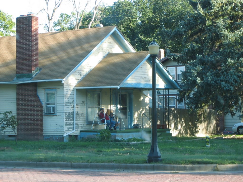
Marilyn found her grandparents' old house, which now appears to be inhabited by "night people" and probably hasn't been painted since her grandfather passed away over 30 years ago. Wanna see the present occupants? Here they are on the front porch, quaffing a couple of brewskies...
We pushed on south through the night to I-70 and then headed East to a well-deserved rest in WaKeeney. Total mileage for the day was just under 400.
Day 4 -- Great America WY to Torrington WY
We super-slabbed it across most of Wyoming today, and as I mentioned before, the average speed was well north of 90 MPH. On several occasions while passing trucks, the speedo exceeded the 100 mark; luckily my passenger either didn't notice, or didn't say anything for fear I would slow down and subject her to more minutes of Wyoming monotony :-) Roxy, our Infiniti FX-35 took the high speeds in stride, and only asked for a little more fuel than usual. Oh, and we did all this through head winds of at least 30 MPH. The ride was smooth and stable, and the aerodynamics of the FX seemed to prevent the buffeting I have experienced in previous similar situations.
After a late lunch / early dinner, we headed North on I-25 to trace the route of the Oregon Trail and the Platte River along US-26. Somewhere before the Fort Laramie historic site, in the middle of the small town of Guernsey, we followed signs to "Wagon Wheel Ruts" and discovered the really neat site that contains "Register Cliff" and real wagon ruts left by those who traveled the Oregon Trail many years ago. I say "real" because most such sites have wide U-shaped channels where many wagons went over the same area, such as a steep descent, and the animals pulling the wagons, and the wagon wheels, combined with years of water erosion, leave channels, not individual wheel ruts. These ruts, however, were different. The ruts are in solid stone. Yes, the steel-tired wagon wheels, thousands of them, cut deep ruts down into solid rock, sometimes two or more feet deep. One particular place still showed what was obviously a place where every draft animal placed it's right foot when starting the ascent up a steep rise. It, too, had to have been worn down from thousands of feet trying to find purchase while pulling the heavy loads. The effort required to make the journey from meeting places such as Saint Louis to eventual ends in Oregon, Utah, and Northern California is astounding, and took a heavy toll. Cholera was common, and all along the way we saw reminders that not all who started the journey made it all the way. At Register Cliff many travelers left their names and date of passage carved in the sandstone cliff, and one in particular is known to have died just a few weeks and 70 miles further down the trail, struck down in the prime of life by cholera. Yes, that's several weeks for 70 miles. Sometime the settlers made only 3 miles a day.
Marilyn and I were discussing what things we have now, things the settlers could have comprehended, that they would have been most impressed with. She thinks it would be the roads we have today. They would be familiar in concept, and they could use them with the technology they possessed, yet could go so much further using them as compared to hacking their way through prairie or struggling up rocky hills. Roads, more than anything else, I think, made this country into the magnificent thing it is today. President Eisenhower is credited with being the father of the Interstate System, but even the great roads that were replaced, such as Route 66 (The Mother Road), the Lincoln Highway, the Yellowstone Trail, the Sunset Highway, and the National Road, to name a few, were more than some countries have today. Before, 3 miles a day, now, and I have done it when I was younger and stupider, 1000 miles a day -- could the Oregon Trail users comprehend three orders of magnitude increase in daily mileage? I wonder....
We, ourselves, made nearly 500 miles on this day and still had time to spend 3 hours exploring the traces left by others.
Unfortunately, no photos, as it appears the camera memory card acted up. The images come up in thumbnail, but won't display. I hope I can find or write a utility to salvage them.
I did find this site, however, and with Daniel's permission, I include a link here. The site contains pictures of well-known sites along the Oregon Trail, and both the Register Cliff name carvings and the wagon wheel ruts cut in stone:
http://www.eg.bucknell.edu/~hyde/jackson/lindaOregonTrip.html
Update -- Day 14 -- A vacation from the vacation
A note on gear.
Clothing, underwear and such are always a problem. Having traveled across the country in a Miata and done a 21-day "Europe Through the Back Door" tour, both requiring traveling with just a carry-on size bag, I've developed a system that works well for me. I really like the REI MTS (Moisture Transport System) underwear. They can be aired out overnight and so worn for two days if necessary, and can be washed in the sink, hung to dry, and be wearable in the morning. Two sets is all you really need, but since we had the larger vehicle for this trip, I splurged and have four sets with me. I have various colors of the tee shirts so they look good contrasting with the REI or similar outdoor shirts I have with me. These are the types with ventilation panels under the back yoke and sleeves that can be rolled up and held there with the straps that are sewn inside the sleeves. I have three of those, and since we can hang them up in side the car when not being worn, they are staying remarkably wrinkle-free. Slacks with the zip-off legs are also excellent for traveling, as they minimize the number of garments and provide great versatility.
Computer gear -- Marilyn has a tiny yet extremely useful Sony Vaio VGN-TX670P and a Microsoft Wireless Laser Mouse 6000. We are using an older but still capable Canon PowerShot S400 Digital ELPH camera, and transferring pictures daily to her computer and a 1-Gig thumb drive. I have a spare battery for the camera and have yet to have to switch batteries during the day, but instead switch them every day so I can recharge one in the evenings or mornings -- they can't be left to charge more than 3 hours or so, and in fact are usually done charging in less than an hour.
I carry tiny travel-sized bottles of hand sanitizer and bug-repellent in my pocket so we can hop out and take walks at interesting sites without being chewed on, and can use "primitive" facilities and stay healthy.
That's about it. Marilyn is keeping in touch by sending out postcards. I'm writing this blog.
So far, the typical minor crises back in the office seem to be getting resolved -- I check my work email almost every morning and have had only a few comments to make.
